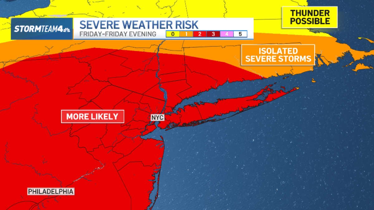
A potent cold front will push through the tri-state area Friday night and produce a line of strong to severe storms in the evening.
After light-to-moderate showers move through the region in the morning, making for a wet morning commute, the rain ends by afternoon and the air becomes very warm and humid under partly cloudy skies. Highs will reach the mid 70s in most places by the afternoon.
Skies dry out through mid-day and the afternoon, but the heat and humidity will serve as the fuel for the cold front to spark the storms later in the evening.
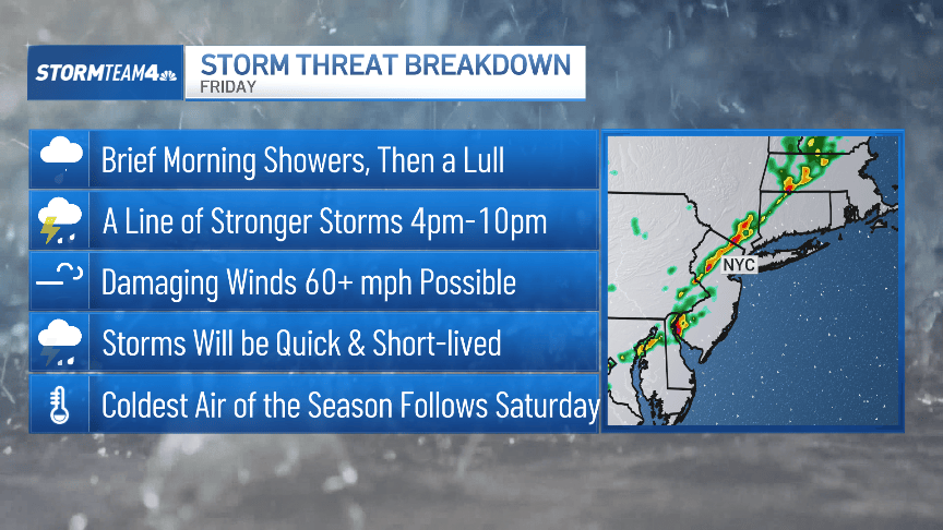
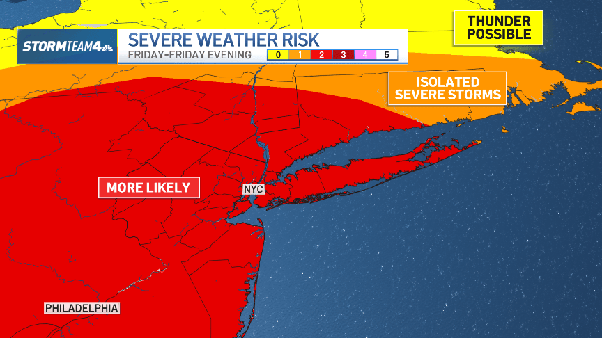
These storms will form a squall line – a straight line of storms that sweeps through the region quickly. The main threat will be destructive wind gusts, and those will be most likely west of New York City.
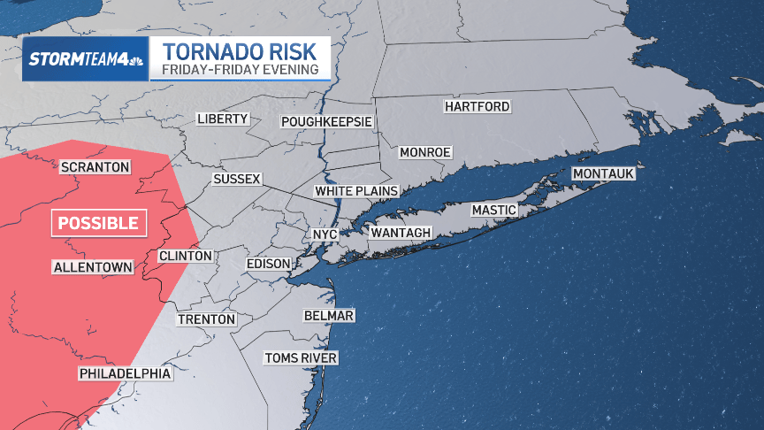
Isolated tornadoes are possible, too, from the Delaware Water Gap westward into Pennsylvania.
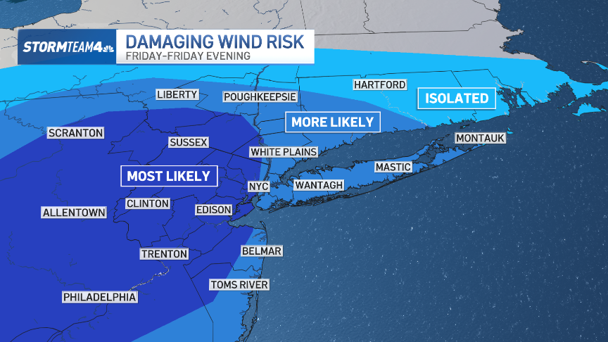
Storms will reach the Catskills and Poconos by late afternoon, between 5 p.m. and 6 p.m. Those storms will then reach the NYC area by about 8 p.m. They’ll move quickly through any given neighborhood, so expect gusty wind, lightning, and heavy downpours for only about 20 to 30 minutes before the storms move on.
The storms will be strongest as they approach the tri-state from the west. They’ll weaken somewhat as evening temperatures cool and the storms reach more stable air near the coast, but they’ll still pack strong wind gusts, even in the New York City metro area.
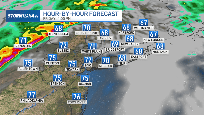
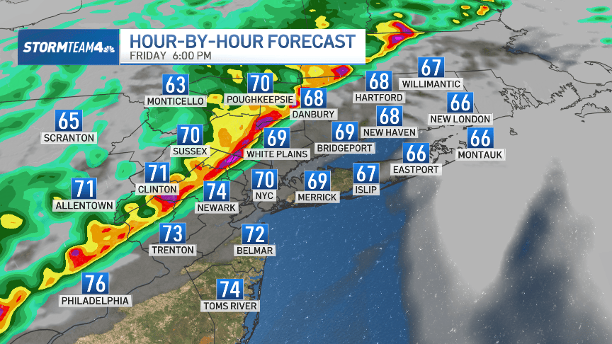
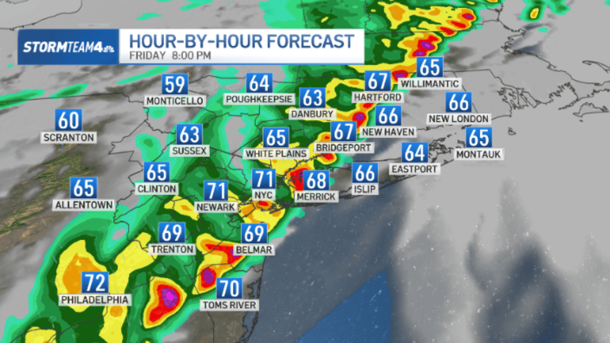
Storms will exit the region by late evening and overnight. Behind them, much cooler air takes hold for the weekend.
Temperatures will hover in the low 50s all day Saturday, with gusty winds adding an extra bite. Skies start cloudy with sun emerging by afternoon.
Sunday will be much calmer and sunnier, but temperatures will still be quite chilly for this time of year – more like November weather than October. In NYC, morning lows will be in the upper 30s with afternoon highs in the mid 50s.
Temperatures moderate to the low and mid-60s next week with dry skies all week long.