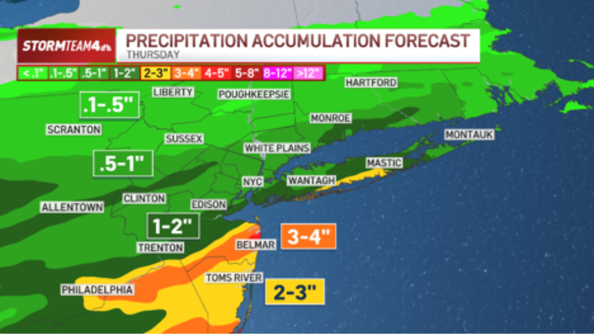
A low pressure system will slide through the tri-state area Thursday afternoon and evening, bringing pockets of heavy rain that could cause flash flooding.
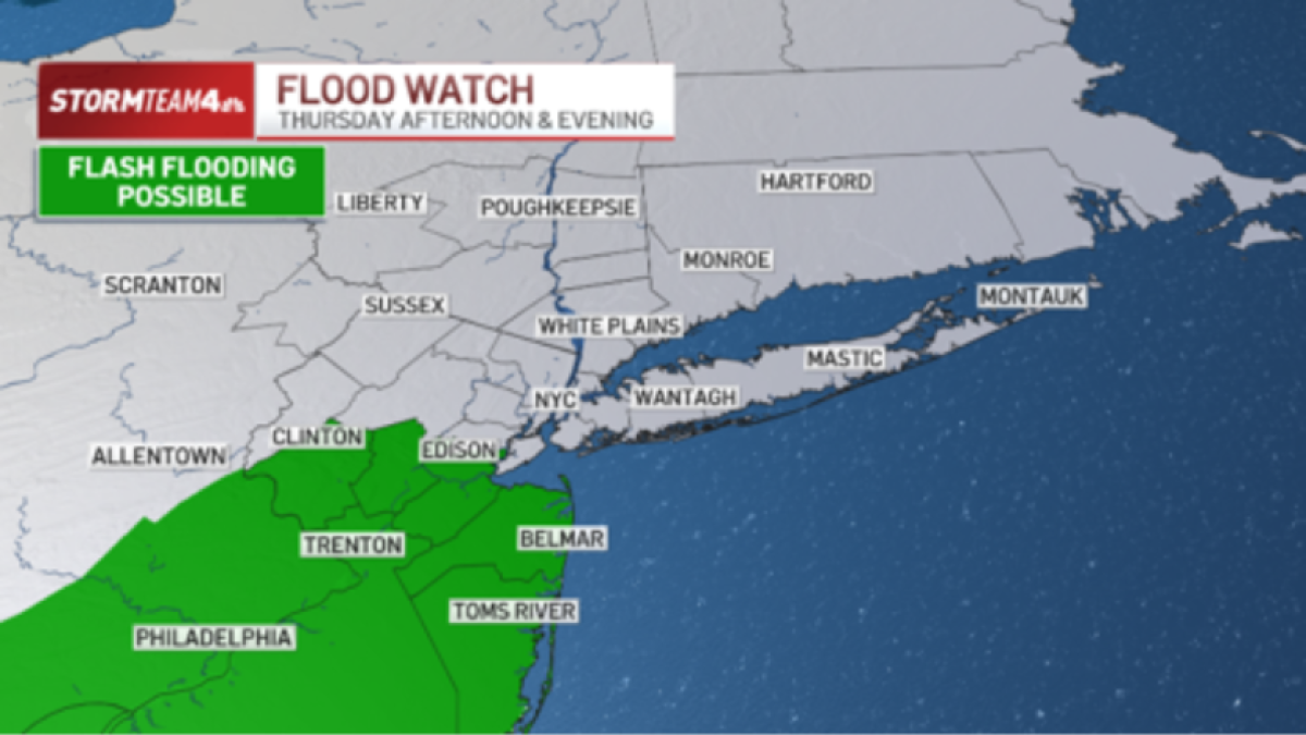
For that reason, a flood watch will go into effect at noon and continue through the evening for Central and South Jersey. This is where the heaviest rain is anticipated.
Farther north, rain will be less intense and flash flooding will be less likely.
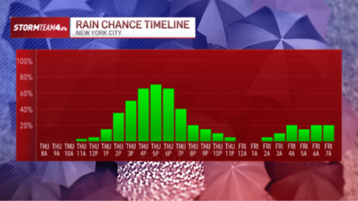
Showers and storms will move in early to mid-afternoon, with the heaviest rain and strongest storms expected between 4 p.m. and 8 p.m. This is when flash flooding will be most likely.
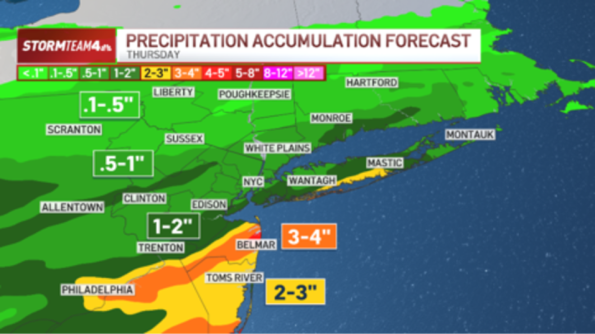
Hardest-hit areas could pick up 3 to 4 inches of rain. Most areas will get less than that.
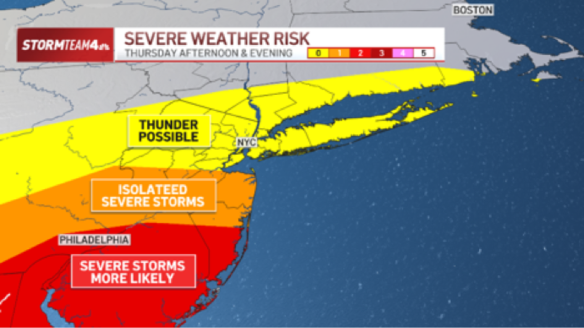
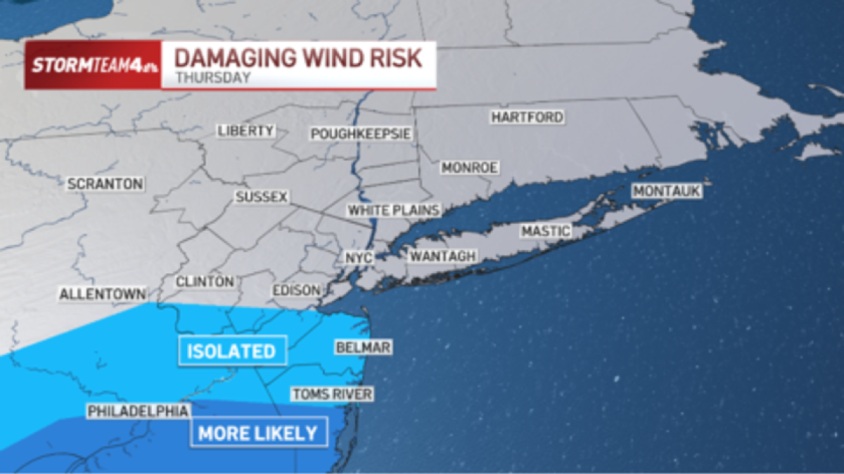
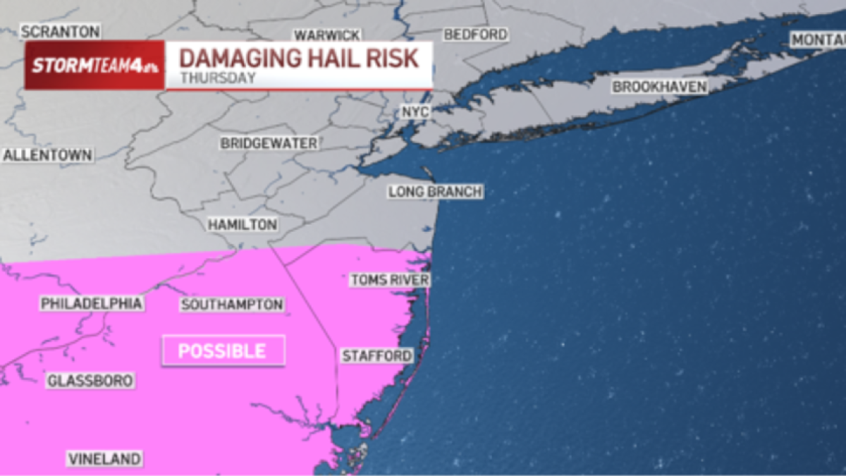
In addition to flooding, severe storms will be possible. South Jersey is at a Level 2 threat, while Central Jersey is at Level 1. To the north, severe storms are less likely.
Damaging straight line wind and large hail will be the most likely threats from the storms.
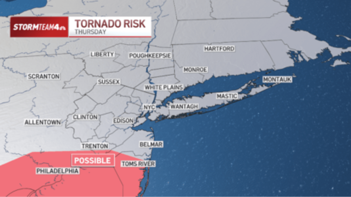
There is also a low-level risk for isolated quick spin-up tornadoes in far southern New Jersey, including Ocean County.
After 8 p.m., showers and storms will begin to weaken and move east, significantly reducing the flood and severe threat.